The National Weather Service has issued a Tornado Watch for Ouachita County until 7:00 p.m. Tuesday.
Primary threats include:
•A few tornadoes, with a couple of intense tornadoes possible.
•Damaging winds up to 75 mph.
•Very large hail up to three inches in diameter.
A Tornado Watch means conditions are favorable for tornadoes and severe thunderstorms in and close to the watch area. If you are in the watch area, be sure to monitor the National Weather Service, your NOAA Weather Radio, or local news for more information on threatening weather conditions and additional severe weather watches or warnings.

Tree and limb debris can be taken to the landfill located on Country Club Road. You will need to come over the scales to be weighed, then will be directed across the street to the dog pound where we are collecting everything.
Citizens may place limbs and debris next to the street and call City Hall 870-837-5500 to give us your address. We will come by and pick this up this week as weather permits.
Public Works is currently removing trees from streets. However, we can not move trees with electric lines in them. Please call 1-800-ENTERGY to report. Once the lines are removed, we will come remove the tree.
Thank You for your patience as we are working together with Entergy and all City Departments to get everyone back ono with power as soon as possible.
Camden Mayor`s Youth Council with Dr. Toney !

Join us at Fairview Park on Mt. Holly Rd. for the Grand Opening of the Camden Pickleball Courts!!!
Come for the Ribbon Cutting on Tuesday, March 31, at 5:30 PM, and stay till sunset and enjoy watching or even participating in some great fun!!!!!
Come for the Ribbon Cutting on Tuesday, March 31, at 5:30 PM, and stay till sunset and enjoy watching or even participating in some great fun!!!!!

Ouachita County Judge Robert McAdoo has issued a burn ban for all of Ouachita County until further notice. All outdoor burning is prohibited.
Hwy 278 Bypass at Cash Road is now clear of debris and open.
Avoid the area of North Street and Avon at this time due to tree and power line down.
Please use caution when traveling West on Hwy 278 Bypass at Cash Road intersection due to a large amount of debris in the road.
The National Weather Service has issued a Severe Thunderstorm Warning for Ouachita County until 6:30 p.m. Sunday.
At 5:47 p.m., a line of severe thunderstorms were located along a line from near Chidester to Stephens, moving east at 40 mph.
60 mph winds are likely. Damage to roofs, siding, and trees is expected.
For your protection, move to an interior room on the lowest floor of the building you are in.
At 5:47 p.m., a line of severe thunderstorms were located along a line from near Chidester to Stephens, moving east at 40 mph.
60 mph winds are likely. Damage to roofs, siding, and trees is expected.
For your protection, move to an interior room on the lowest floor of the building you are in.
The National Weather Service has issued a Tornado Watch for Ouachita County until 9:00 p.m. Sunday.
Primary threats include:
•A few tornadoes, with a couple of intense tornadoes possible.
•Damaging winds up to 75 mph.
•Large hail up to two inches in diameter.
A Tornado Watch means conditions are favorable for tornadoes and severe thunderstorms in and close to the watch area. If you are in the watch area, be sure to monitor the National Weather Service, your NOAA Weather Radio, or local news for more information on threatening weather conditions and additional severe weather watches or warnings.
Attention Residents!!!!!
Paving Crews will begin work on Sharp Ave from W. Washington to Maul Rd. starting at 7:30 am on March 13, 2026. Please use Caution in this area and plan an alternative route.
Paving Crews will begin work on Sharp Ave from W. Washington to Maul Rd. starting at 7:30 am on March 13, 2026. Please use Caution in this area and plan an alternative route.

Camden Fire Department Information!!
The Camden Fire Department will be conducting hydrant flow tests throughout the city this week, March 9-13, in order to help develop plans for future emergency operations. As part of this testing, large volumes of water will be flowed from hydrants, which may disturb sediment in water mains.
This may cause discolored water to appear at faucets. Customers should run water from cold taps (not hot) until the water clears, and use caution when doing laundry, as any discolored water may stain clothes. Hydrants are expected to be tested at the following locations today (Monday, March 9), but these locations may change, and sediment may be stirred up several blocks from them.
• 2500 Block of Ridgeview Road NW
• Intersection of Maul Road NW and Sharp Avenue NW
• Intersection of McCullough Street NW and Helen Avenue NW
• Intersection of West Washington Street and Eagle Avenue NW
• Intersection of Ridgeway Street NW and Berg Avenue NW
The department will attempt to prevent or limit as many issues as possible. We appreciate your understanding as we continue working to keep you safe!
Due to the expected rain on Saturday, March 7, 2026, the Clean-Up Camden Event has been rescheduled for Saturday, March 21, 2026. Get your Team or Group together, and let's all help clean up Camden.

Come out and help us honor L.C. "Buckshot " Smith

Join the Keep Camden Beautiful Committee for a community-wide clean-up event to help make Camden Shine.
Saturday, March 7th, from 9:00 am - 2:00 pm. Supplies (Gloves, Grabbers, & Trash Bags) will be provided.
Register your Team, Group, or Organization by Emailing Ed Winters at edwardwinters54@gmail.com.
Saturday, March 7th, from 9:00 am - 2:00 pm. Supplies (Gloves, Grabbers, & Trash Bags) will be provided.
Register your Team, Group, or Organization by Emailing Ed Winters at edwardwinters54@gmail.com.

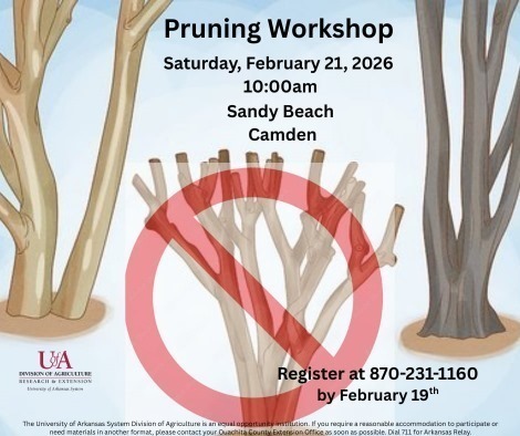
Join the local Extension Services for a pruning workshop on February 21, 2026. If you plan to attend, please register by February 19th.
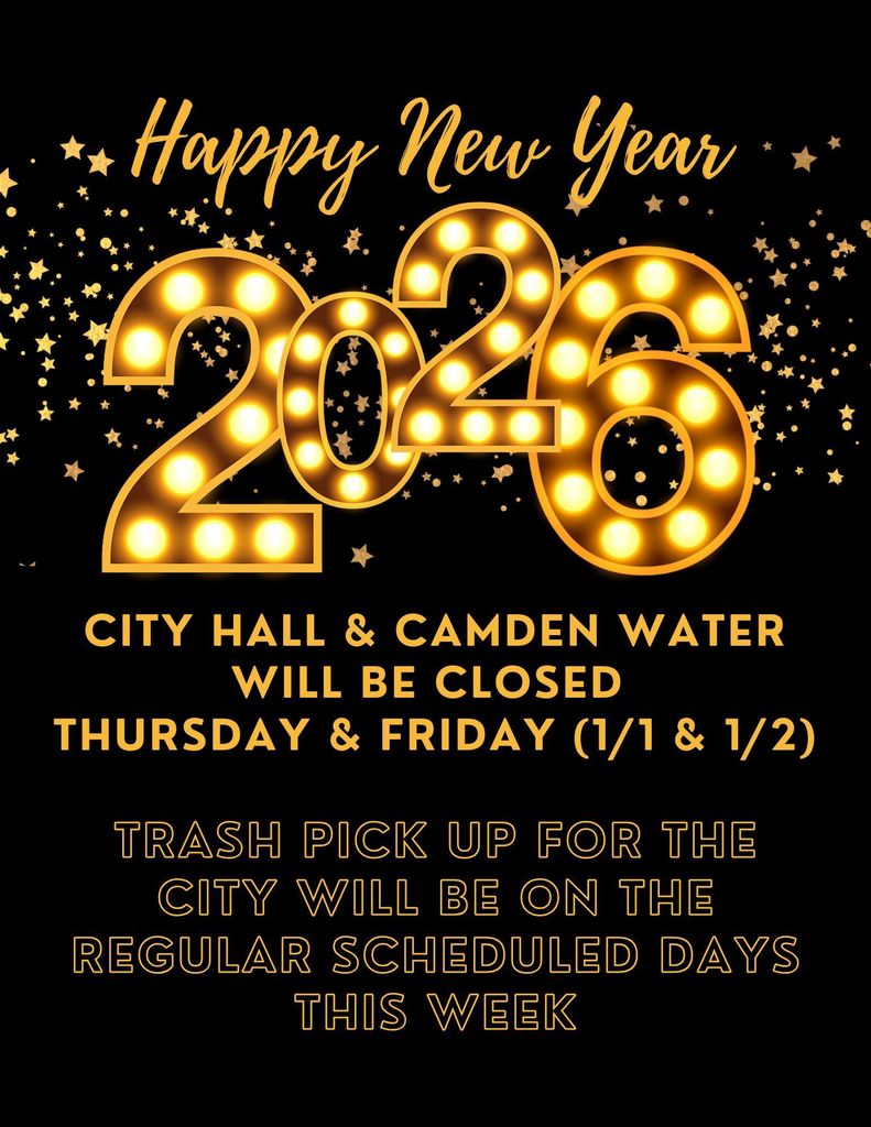
Happy New Year 2026!
Camden City Hall and Camden Water will be closed Thursday and Friday (1/1 & 1/2) this week.
Sanitation department will be running trash routes on the regular scheduled day this week.
Camden City Hall and Camden Water will be closed Thursday and Friday (1/1 & 1/2) this week.
Sanitation department will be running trash routes on the regular scheduled day this week.
Let's have some fun!!

PSA!!!!
Hello Camden Residents, I wanted to post a reminder that, with the holidays approaching, there will still be availability for Special Pick-Ups. But please try to get your pick-up called in the week before the holidays, to make sure you're on the list to get picked up as soon as possible before the holidays.
Don't forget that everything has to be separated into its own pile. pine straw and leaves also have to be bagged. (THIS IS NOT CONSIDERED AS REGULAR RESIDENT TRASH PICK-UP)
The charge will be added to your water as usual.
-The first ten minutes are a $10.00 charge. If the pick-up is longer than 10 minutes, an additional charge of $0.75 per minute will be added to whatever you are charged for during the pick-up.
Please call your pick-up into Public Works at 870-837-5500
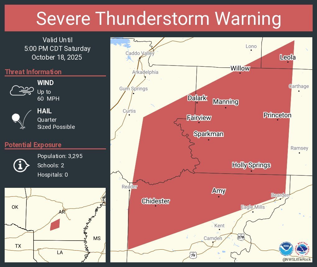
The National Weather Service has issued a Severe Thunderstorm Warning for northern Ouachita County until 5:00 p.m. Saturday.
60 mph winds and quarter-sized hail are likely. Damage to roofs, siding, and trees is expected.
For your protection, move to an interior room on the lowest floor of the building you are in.
60 mph winds and quarter-sized hail are likely. Damage to roofs, siding, and trees is expected.
For your protection, move to an interior room on the lowest floor of the building you are in.